Navigation Aids
 An Aid to Navigation (sometimes called AtoN, Navigation Aid,
or NavAid) is a device or structure external to a craft,
designed to assist in determination of position, to define a
safe course, or to warn of dangers or obstructions
(Bowditch, 1995). Common examples of AtoN are
buoys, beacons, lighthouses, racons and electronic
navigation systems such as loran, GPS and DGPS. (The
terms "Navigation Aid" and "NavAid"
are properly used only for navigation equipment and
techniques used aboard a vessel or aircraft.
However, common usage often substitutes these terms for
Aids to Navigation -- devices which are external
to the vessel.)
An Aid to Navigation (sometimes called AtoN, Navigation Aid,
or NavAid) is a device or structure external to a craft,
designed to assist in determination of position, to define a
safe course, or to warn of dangers or obstructions
(Bowditch, 1995). Common examples of AtoN are
buoys, beacons, lighthouses, racons and electronic
navigation systems such as loran, GPS and DGPS. (The
terms "Navigation Aid" and "NavAid"
are properly used only for navigation equipment and
techniques used aboard a vessel or aircraft.
However, common usage often substitutes these terms for
Aids to Navigation -- devices which are external
to the vessel.)
Here are some examples of aids to navigation consulting services formerly offered by Captain Cattalini:
 Planning, selection, installation, operation and maintenance of aids to navigation marking offshore and coastal features, harbor approaches, ports, waterways, and river systems.
Administration and management of aids to navigation systems.
International buoyage systems including proper, effective use of lighthouses, buoys, beacons, fog signals and racons.
Integration of loran, GPS and differential GPS (DGPS) into systems of conventional, short range aids to navigation.
Positioning of aids to navigation.
Design and operation of buoy tenders and other servicing craft.
Training of administrative and servicing personnel.
Vessel Traffic Services (VTS) |
Waterway Management |
Maritime Litigation |
Marine Information |
Bridges Across Navigable Waterways |
Navigation Regulations |
Home
~~~~~~~~~~~~~~~~~~~~~~~~~~~~~~~~
Vessel Traffic Services (VTS)
 A Vessel Traffic Service (VTS) is defined by the International Maritime Organization (IMO) and the International Association of Maritime Aids to Navigation and Lighthouse Authorities (IALA) as "a service implemented by a competent authority designed to improve safety and efficiency of vessel traffic and protect the environment. The service shall have the capability to interact with the traffic, and respond to traffic situations developing in the VTS area." Communications are the key element of every VTS. Most VTSs maintain positive surveillance of vessel traffic, usually by radar and AIS (Automatic Identification Systems). Many VTSs use closed circuit TV and some utilize radio direction finders.
Here are some examples of VTS consulting services formerly offered by Captain Cattalini:
Design and operation of VTS systems.
Use and location of remote surveillance and communication systems.
Standard operating procedures and user manuals and regulations.
Identification and satisfaction of user needs and concerns.
Low cost alternatives to complex VTS systems.
Training and certification of VTS personnel.
Navigation Aids |
Waterway Management |
Maritime Litigation |
Marine Information |
Bridges Across Navigable Waterways |
Navigation Regulations |
Home
~~~~~~~~~~~~~~~~~~~~~~~~~~~~~~~~
Waterway
Management
 The U.S. Coast Guard defines waterway management as "the proactive stewardship of America's navigable waters to promote their safe, efficient and environmentally sound use among competing interests." Waterway management is accomplished with a variety of rules, policies and procedures. Typical examples of waterway management tools are the rules of the road, navigation regulations, traffic separation schemes and other routing measures and, of course, vessel traffic services.
Here are some examples of waterway management consulting services formerly offered by Captain Cattalini:
Structural, operational and regulatory techniques to facilitate safe and efficient traffic flow.
Navigation, piloting and safe vessel operation.
Inland and international navigation rules.
Effective use of offshore routing measures, traffic separation schemes, vessel movement reporting systems, bridge-to-bridge radiotelephone, pilotage, port and terminal design and construction, restricted or limited-access areas, anchorage grounds.
Navigation Aids |
Vessel Traffic Services (VTS) |
Maritime Litigation |
Marine Information |
Bridges Across Navigable Waterways |
Navigation Regulations |
Home
~~~~~~~~~~~~~~~~~~~~~~~~~~~~~~~~
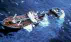
Maritime Litigation
 The issues in admiralty claims and litigation can be confusing, cumbersome and ultimately costly. They require the advice of a competent admiralty lawyer. Such attorneys utilize the expertise of maritime experts in various phases of a case, including use as expert witnesses in admiralty court. Captain Cattalini has had years of experience in providing professional assistance in developing, resolving, settling or litigating admiralty cases.
Here are some examples of maritime litigation consulting services formerly offered by Captain Cattalini:
Critical review and analysis of maritime incidents to determine probable cause, potential negligence and corrective actions.
Identification of strengths and weaknesses of parties to facilitate settlement or successful litigation.
Testimony as an expert witness in admiralty courts.
For legal information:
Bryant's Maritime Consulting, operated by a former colleage, Dennis L. Bryant, offers timely information on maritime developments including legislation, court decisions and agency actions. His blog and daily newsletter provide extensive information on legal and regulatory issues.
Click
here for another web site that provides an excellent
overview of maritime and
admiralty law with many links for researching legal
issues.
For other information at this site:
Navigation Aids |
Vessel Traffic Services (VTS) |
Waterway Management |
Marine Information |
Bridges Across Navigable Waterways |
Navigation Regulations |
Home
~~~~~~~~~~~~~~~~~~~~~~~~~~~~~~~~
Marine Information
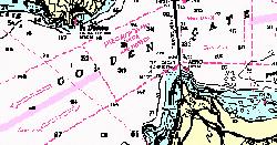 Marine Information is a generic term referring to the
publications and other information, usually governmental in
origin, required for safe navigation. Common examples of
marine information are Light Lists, Notices to Mariners,
Nautical Charts, and Coast Pilots and Sailing Directions.
Primary suppliers of marine information for U.S. waters are the
Coast Survey of
the National Ocean Service and various offices of the U.S. Coast Guard. Marine information
for other waters is provided by the National Geospatial-Intelligence Agency and by
other national hydrographic authorities including the United Kingdom Hydrographic Office ("British Admiralty"). The Canadian Coast Guard publishes Notices to Mariners and Lists of Lights for Canadian waters. Worldwide standards
for nautical charting are developed and promulgated by the
International Hydrographic
Organization.
Marine Information is a generic term referring to the
publications and other information, usually governmental in
origin, required for safe navigation. Common examples of
marine information are Light Lists, Notices to Mariners,
Nautical Charts, and Coast Pilots and Sailing Directions.
Primary suppliers of marine information for U.S. waters are the
Coast Survey of
the National Ocean Service and various offices of the U.S. Coast Guard. Marine information
for other waters is provided by the National Geospatial-Intelligence Agency and by
other national hydrographic authorities including the United Kingdom Hydrographic Office ("British Admiralty"). The Canadian Coast Guard publishes Notices to Mariners and Lists of Lights for Canadian waters. Worldwide standards
for nautical charting are developed and promulgated by the
International Hydrographic
Organization.
Here are some examples of marine information consulting services formerly offered by Captain Cattalini:
Compilation, distribution, and use of marine information including broadcast and printed notices to mariners, weather advisories, light lists, coast pilots and sailing directions.
Hydrography, cartography and nautical charts, including electronic chart display information systems (ECDIS).
Navigation Aids |
Vessel Traffic Services (VTS) |
Waterway Management |
Maritime Litigation |
Bridges Across Navigable Waterways |
Navigation Regulations |
Home
~~~~~~~~~~~~~~~~~~~~~~~~~~~~~~~~
Bridges Across Navigable Waterways
 U.S. law generally prohibits construction or modification of bridges across navigable waters without prior authorization from the Coast Guard to ensure that the location and clearances meet the reasonable needs of navigation. The law also charges the Coast Guard with regulating the operation of movable span bridges (drawbridges).
Here are some examples of bridge related consulting services formerly offered by Captain Cattalini:
Analysis of existing and potential future vessel clearance requirements for new or reconstructed bridges.
Guidance on location and clearances to reduce controversy, costs and delays.
Identification and documentation of navigation impacts of bridge location for environmental impact statements.
Preparation of required application documents for Coast Guard construction permits.
Review and analysis of drawbridge operating procedures and regulations.
Navigation Aids |
Vessel Traffic Services (VTS) |
Waterway Management |
Maritime Litigation |
Marine Information |
Navigation Regulations |
Home
~~~~~~~~~~~~~~~~~~~~~~~~~~~~~~~~
Navigation Regulations
 Most navigation regulations promulgated by the U.S. government are contained within Title 33 of the Code of Federal Regulations. Even more fundamental than these regulations issued by the U.S. Coast Guard, the Corps of Engineers and the Saint Lawrence Seaway Development Corporation are the Navigation Rules. The International Regulations for Preventing Collisions at Sea, 1972 (commonly called 72 COLREGS) is an international treaty ratified by the United States. The COLREGS apply on the high seas and on those U.S. waters
outside of established navigational lines of demarcation. The Inland Rules, which apply inside these lines, were established by the Inland Navigational Rules Act of 1980, a Federal statute. Both sets of rules have been subsequently amended. In addition to these rules, vessels may be subject to laws and regulations promulgated by States and local authorities.
Most navigation regulations promulgated by the U.S. government are contained within Title 33 of the Code of Federal Regulations. Even more fundamental than these regulations issued by the U.S. Coast Guard, the Corps of Engineers and the Saint Lawrence Seaway Development Corporation are the Navigation Rules. The International Regulations for Preventing Collisions at Sea, 1972 (commonly called 72 COLREGS) is an international treaty ratified by the United States. The COLREGS apply on the high seas and on those U.S. waters
outside of established navigational lines of demarcation. The Inland Rules, which apply inside these lines, were established by the Inland Navigational Rules Act of 1980, a Federal statute. Both sets of rules have been subsequently amended. In addition to these rules, vessels may be subject to laws and regulations promulgated by States and local authorities.
Here are some examples of relevant consulting services formerly offered by Captain Cattalini:
Review of existing and proposed regulations to facilitate client understanding, compliance or constructive input.
Preparation and presentation of petitions for appropriate rulemaking, including interpretation, revision or recission of existing rules.
For sources of legal and regulatory information: click here.
For other information at this site:
Navigation Aids |
Vessel Traffic Services (VTS) |
Waterway Management |
Maritime Litigation |
Marine Information |
Bridges |
Navigation Regulations |
About Capt. Cattalini |
Contact Capt. Cattalini |
Maritime Humor |
Site Directory |
Home
Copyright © 1997-2010 Alvin Cattalini